| Aboard the Sailing Vessel | |
| SHIBUMI | |
| January 17, 2005 |
|
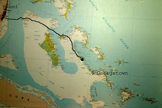
Map Showing Shibumi's Path
Disregard the black dot in the middle of the map. It is merely the screw that holds the map on our wall.
|
|
|
|
The heavy dark line shows the route we have taken so far. The line stops where we are today... Which is Sampson Cay in the Exumas. Again disregard the black dot in the center of the map... it is simply a screw that holds the map on our bulkhead (wall). Our destination is Georgetown, which is about 50 miles southeast of our current position. We are in NO hurry to get to Georgetown. There are several Cays we want to visit along the way. After Sampson Cay is Stanial Cay, then comes Blackpoint, followed by Little Farmers Cay. Little Farmers Cay is the only stop we have placed a date on. The first Friday in February there is a festival there. We want to be in Little Farmers Cay for the festival. The Tongue of the Ocean can be seen on the map to the west of our position. The light colored areas that surround the Tongue of the Ocean is the Great Bahama Bank. The water in the Bank is not as deep as the water in the Tongue. The are parts of the Ocean in that area that go as deep as 8,000 ft. |
|
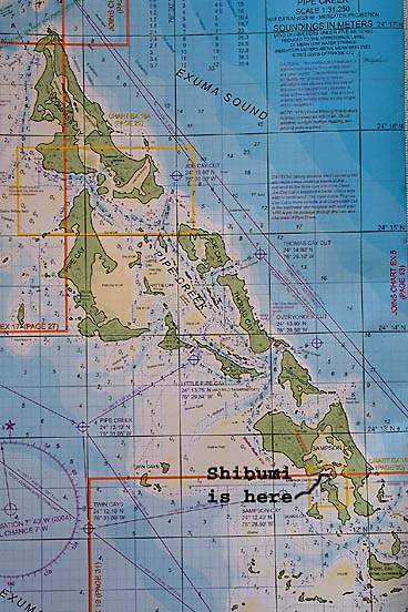
Expanded Map of Shibumi's Position
The boats that we have been traveling with, Dark and Stormy and Brass Dragon, are in Warderwick Wells, which is about ten miles north of the top of this map. Other ships that have been featured on the site, Breathless, stargazer, and Water Music are further south. They are about two miles south of bottom of this map. In the middle of the map is Pipe Creek. That is where many boats went to hide from the cold front. Several of them dragged their anchor and relocated near us in Sampson Cay.
|
|
| Use your browser's back button to select another date |